Nepal Disaster Update Live coverage

Archived event

USGS: the tremor was a glacial collapse, not an earthquake

This briefing has been overtaken

It was published at 27 August 2026, 10:00 am NPT and is kept online as the record of what was confirmed at that hour. Figures in it are no longer current.

Read the latest briefing: 289 confirmed dead in the Rasuwa flood as searches reach cut-off areas · Current event summary

The US Geological Survey first logged a magnitude 4.4 earthquake at 08:37 on Wednesday, minutes before the river rose. It has now revised that analysis.

Its conclusion is that the signal was a magnitude 5.2 glacial collapse rather than a tectonic earthquake, based on nearby seismic stations, long-period seismic waves and satellite imagery. In other words the tremor was not a separate trigger. It was the collapse itself being recorded.

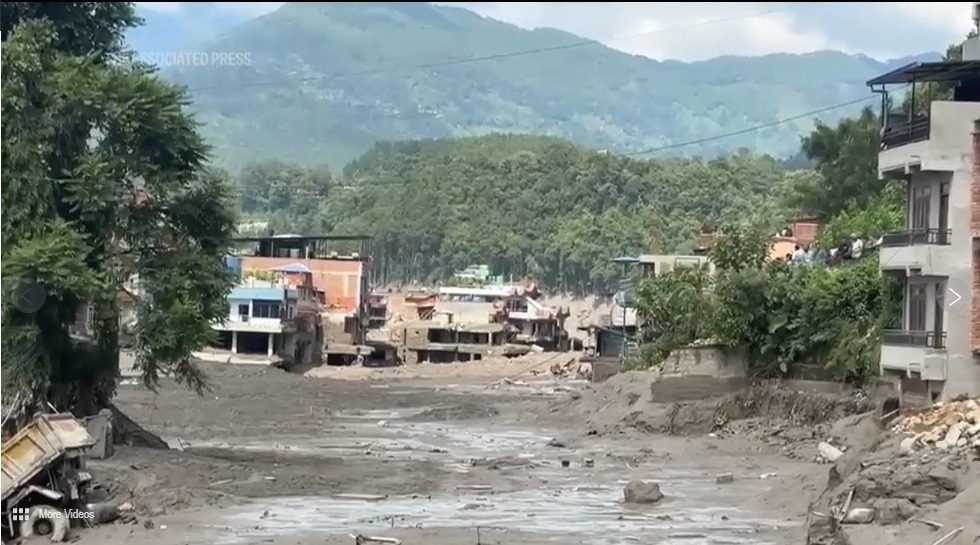
Nepal's Department of Hydrology and Meteorology and independent glaciologists, working from satellite imagery shared by Chinese counterparts through ICIMOD, put forward a preliminary explanation: an ice-and-rock avalanche blocked the Lhende Khola, a Bhote Koshi tributary on the border, about 20 km upstream of the Miteri Bridge. That formed a temporary debris-dammed lake, which then burst.

No government has officially confirmed a cause. This remains a hypothesis, described as preliminary by the people who proposed it.

Meteorologists have ruled out heavy local rainfall in Rasuwa, while noting that satellite data showed rain on the Tibetan side of the border.

A broadly similar flood on the same river in July 2025 was ultimately attributed to the drainage of a supraglacial lake. ICIMOD scientists say cascading glacial hazards are increasing at an unprecedented pace across the Hindu Kush Himalaya.

Sources for this briefing

Written and checked by hand against the sources above. Figures are attributed to the bulletin they came from; where two sources disagreed, the lower confirmed figure was used. If something here is wrong, tell us and it gets corrected or removed.