Live coverage
Map of the Rasuwa flood path
From the suspected break-off point inside Tibet, 4,500 metres down to Nuwakot. Every point with coordinates, as a table first and a map second.
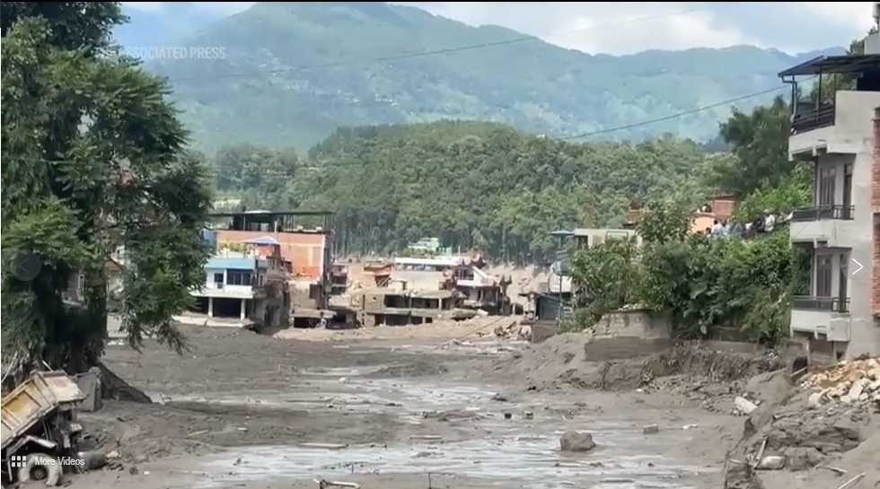
The flood did not start in Nepal. It began high inside Tibet and fell more than 3,000 metres before it reached the first Nepali town. Below is every point along that route, with its coordinates, followed by an interactive satellite map.
Every point along the flood path
| # | Place | Coordinates | Elevation | What happened |
|---|---|---|---|---|
| 1 | Glacial source area, Lende Khola headwaters China (Tibet) | 28.4402, 85.4432 | ~5,000 m | High above the Lende Khola on the Tibetan side. Satellite images reviewed by researchers suggest a mass of ice and rock broke away here first. There is no monitoring station upstream of this point on either side of the border. |
| 2 | Lende Khola blockage China (Tibet) | 28.3050, 85.4020 | ~3,000 m | The ice and rock dammed the narrow valley, water built up behind the plug, and the plug then failed. That is the step that turned a landslide into a flood. About 20 km upstream of the Rasuwagadhi crossing. No rain was recorded nearby that morning. |
| 3 | Rasuwagadhi / Gyirong border crossing Nepal-China border | 28.2760, 85.3770 | ~1,850 m | The China-Nepal crossing. The Lende Khola and the Kyirong Tsangpo meet here and become the Bhote Koshi. Customs and dry-port facilities were hit on both sides. China has confirmed three deaths near Gyirong. |
| 4 | Timure Rasuwa, Nepal | 28.2350, 85.3730 | ~1,900 m | A border market town, and the worst-hit settlement in Nepal. Nine bank branches and the customs post were swept away. |
| 5 | Syabrubesi Rasuwa, Nepal | 28.1620, 85.3340 | ~1,470 m | Gateway town for the Langtang trek, and the point where the Bhote Koshi joins the Trishuli. The helipad was destroyed, which slowed rescue flights into the upper valley on the first day. |
| 6 | Betrawati Rasuwa / Nuwakot boundary, Nepal | 27.9660, 85.1830 | ~730 m | About 60 km downstream on the district boundary. By here the water had lost height but not force; the bridge and riverside settlements were hit. |
| 7 | Devighat Nuwakot, Nepal | 27.9050, 85.1350 | ~460 m | The furthest downstream point where damage has been reported. Devighat Hydropower Station was hit. From the source area down to here is a drop of roughly 4,500 metres. |
Interactive map
Satellite imagery © Esri, Maxar, Earthstar Geographics and the GIS user community. The table above carries the same information without needing the map to load.
Open the full interactive flood map on the live dashboard. It adds terrain and street layers and an animated play-through of the route.
Why this valley floods hard
A 3,000-metre drop in under 40 km
One of the steepest river runs in the Himalaya. Water released upstream reaches a village in under an hour. There is almost no time to move.
One river, two names
Above the confluence at Syabrubesi it is the Bhote Koshi. Below, it is the Trishuli. Same water. In Tibet the upper river is the Kyirong Tsangpo, fed by the Lende Khola where the ice and rock came down.
It happened here in July 2025
A broadly similar flood struck the same river thirteen months earlier, attributed to the drainage of a supraglacial lake. Hydropower on this corridor has now been hit twice in just over a year.
Which districts the water passed through
Rasuwa was hit hardest. The water then ran through Nuwakot along the Trishuli, and bodies have been recovered as far downstream as Chitwan on the Narayani, six districts below the source.
| District | Province | Role in this event |
|---|---|---|
| Rasuwa | Bagmati | Origin point in Nepal. Timure and Syabrubesi hit hardest; Rasuwagadhi border crossing damaged. |
| Nuwakot | Bagmati | Downstream along the Trishuli. Betrawati, Trishuli Bazaar and Devighat affected; multiple hydropower sites damaged. |
| Dhading | Bagmati | Further downstream. Bodies recovered; district allocated relief funds. |
| Chitwan | Bagmati | On the Narayani. The largest number of bodies recovered. |
| Gorkha | Gandaki | Bodies recovered along the river. |
| Tanahun | Gandaki | Bodies recovered along the river. |
| Nawalparasi East and West | Gandaki / Lumbini | Bodies recovered furthest downstream on the Narayani. |